Categories
- Africa (147)
- Cape Verde (14)
- Morocco (133)
- Americas (90)
- USA (90)
- Detroit (21)
- Grand Teton (1)
- Michigan (54)
- New York (2)
- Yellowstone (10)
- USA (90)
- Art (13)
- Asia (425)
- B&W (149)
- Body (35)
- Drone photography (7)
- Europe (397)
- Fauna (31)
- Flora (176)
- Cannabis (42)
- Opium / Poppy (24)
- Landscape (448)
- Macro (22)
- Middle East (6)
- People (433)
- Sepia (2)
- Sport (51)
- Climbing (42)
- Still life (113)
- Strobist (flash) (15)
- Uncategorized (3)
- Urban (203)
- Architecture (62)
Shot Notes
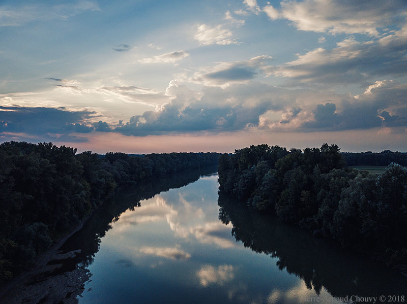
ENG: Sunset (aerial view from DJI Mavic Pro) over the Tisza River near Panyola, Hungary. The Tisza begins near Rakhiv in the Ukrainian Carpathians, delineates parts of the border bewteen Ukraine and Romania, joins the Danube in Serbia, and is one of the richest in fish of all Europe. Attila the Hun is said to have been buried under a diverted section of the river.
FR: Coucher de soleil (vue aérienne: DJI Mavic Pro) au-dessus de la rivière Tisza, preès de Panyola, Hongrie. La Tisza prend sa source près de Rakhiv dans les Carpates ukrainiennes, marque une partie de la frontière entre l’Ukraine et la Roumanie, se jette dans le Danube en Serbie et est l’une des rivières les plus poissonneuses d’Europe. Atilla le Hun aurait été enterré sous un bras de la rivière.
Category: Drone photography • Europe • Hungary • Landscape • River • Sunset
Image URL: http://photo-tropism.com/blog/europe/sunset-over-the-tisza-river/